Historical Maps of the Town
Below are several historical maps of the Town of Canandaigua; the oldest dating back to 1852. Click on each map image to view a larger version of that map.
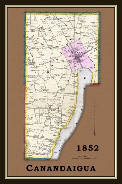
Exerpted from:
Walling, H. F. (1852) Ontario County, New York, From Actual Surveys. [Map]. Philadelphia: John E. Gillett. Retrieved from the Library of Congress, https://www.loc.gov/item/2006636780/.
Note: if you follow the Library of Congress link, there is an option to view the entire original map.
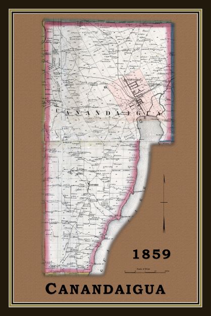
Exerpted from:
Beers, S. N., Beers, D. G., Dawson, A. R. Z. & Gillette, J. E. (1859). Map of Ontario County, New York. [Map]. 1:42,240. Philadelphia, PA: A.R.Z. Dawson. Retrieved from the Library of Congress, https://www.loc.gov/item/2013593229/.
Note: if you follow the Library of Congress link, there is an option to view the entire original map.
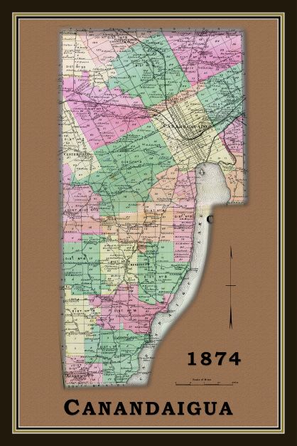
Auth. Unknown (1874). Canandaigua 001, Cheshire, Centerfield. [Map]. 1:39,600. In, Ontario County 1874. Philadelphia, PA: Pomeroy, Whitman, and Co. (pg. 18-19).
Note: Viewable online here: historicmapworks.com. This title is also available at the Ontario County Historical Society.
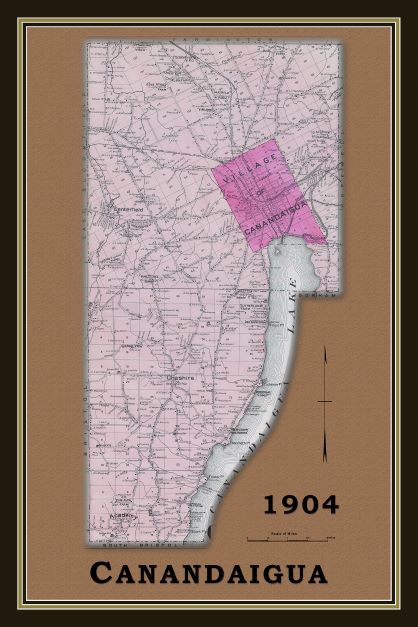
Auth. Unknown (1904) Canandaigua. [Map]. In, New Centry Atlas of Ontario County, New York, with Farm Records. Philadelphia, PA: Century Map Company. (pg. 64-65).
Note: Viewable online here: historicmapworks.com.
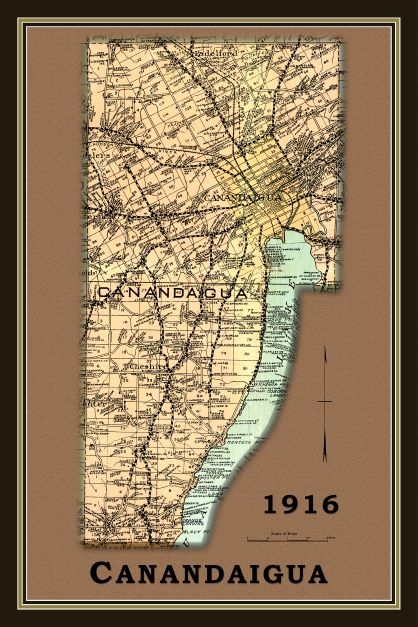
Auth. Unknown (1916-1917) Ontario County Map. Rand McNally. [Map]
Note: This map is available at the Ontario County Historical Society.
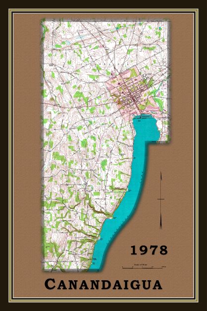
US Geological Survey (1978) Canandaigua Lake, NY Quadrangle. [Map]. 1:24,000. Washington, DC: USGS.